
Thank you for supporting this site ❤️
Make a donation
Make a donation
Gear up for your next adventure:
As an Amazon Associate, this site earns from qualifying purchases at no extra cost to you.
Lamas topographic map
Click on the map to display elevation.
Thank you for supporting this site ❤️
Make a donation
Make a donation
Gear up for your next adventure:
As an Amazon Associate, this site earns from qualifying purchases at no extra cost to you.
About this map
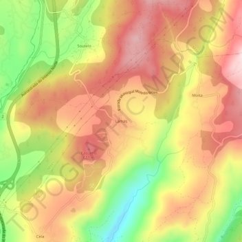
Name: Lamas topographic map, elevation, terrain.
Location: Lamas, Moledo, Castro Daire, Viseu, 3600-458, Portugal (40.81205 -7.93298 40.85205 -7.89298)
Average elevation: 534 m
Minimum elevation: 346 m
Maximum elevation: 671 m
Thank you for supporting this site ❤️
Make a donation
Make a donation
Gear up for your next adventure:
As an Amazon Associate, this site earns from qualifying purchases at no extra cost to you.