Geolocate

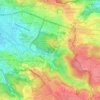
Halytskyi District topographic map

Click on the map to display elevation.

About this map

Name: Halytskyi District topographic map, elevation, terrain.

Location: Halytskyi District, Lviv, Lviv Urban Hromada, Lviv Raion, Lviv Oblast, Ukraine (49.81584 24.00387 49.85234 24.05568)

Average elevation: 315 m

Minimum elevation: 268 m

Maximum elevation: 378 m

Other topographic maps

Click on a map to view its topography, its elevation and its terrain.
X

Ukraine > Lviv Oblast > Lviv

Average elevation: 335 m

Gear up for your next adventure:

💡LED Camping Lantern - Illuminate your campsite with long-lasting lanterns
🧢Outdoor Cap - Protective cap for sun and rain during hikes
🐕Hiking Dog Pack - Let your canine companion carry their own water and food
🧊Portable Cooler - Keep food and drinks cold during outdoor adventures
🎒Backpack Rain Cover - External shield to keep your entire pack dry

As an Amazon Associate, this site earns from qualifying purchases at no extra cost to you.