Geolocate

Ciawigebang topographic map

Click on the map to display elevation.

About this map

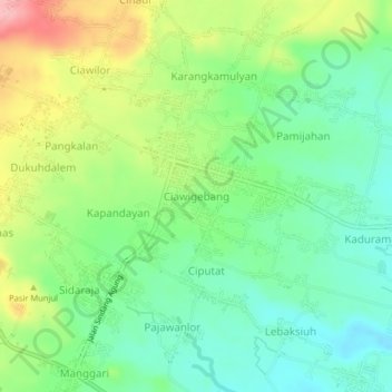
Name: Ciawigebang topographic map, elevation, terrain.

Location: Ciawigebang, Kuningan, West Java, Java, 45573, Indonesia (-6.99441 108.56058 -6.95441 108.60058)

Average elevation: 207 m

Minimum elevation: 156 m

Maximum elevation: 296 m

Other topographic maps

Click on a map to view its topography, its elevation and its terrain.

Gear up for your next adventure:

🧢Outdoor Cap - Protective cap for sun and rain during hikes
👖Convertible Hiking Pants - Zip-off legs to adapt to changing weather conditions
🧴Waterproofing Spray - Restore the DWR coating on jackets and tents
Camping Groundsheet - Protect your tent from moisture and dirt
🧥Softshell Hiking Jacket - The perfect balance of wind protection and breathability

As an Amazon Associate, this site earns from qualifying purchases at no extra cost to you.