Geolocate

Croy topographic map

Click on the map to display elevation.

About this map

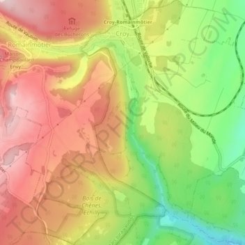
Name: Croy topographic map, elevation, terrain.

Location: Croy, District du Jura-Nord vaudois, Vaud, 1322, Switzerland (46.66961 6.46247 46.69848 6.50042)

Average elevation: 660 m

Minimum elevation: 519 m

Maximum elevation: 775 m

Other topographic maps

Click on a map to view its topography, its elevation and its terrain.

Gear up for your next adventure:

🔦UV Flashlight - Detect minerals or specific insects in the dark
🧥Thermal Fleece Jacket - Versatile insulation for changing mountain temperatures
Camping Tent - Weather-resistant tents suitable for 2 to 6 people
🛏️Sleeping Bag - Warm and compact sleeping bags for outdoor camping
🧤Rechargeable Heated Gloves - Extreme warmth for Canadian winter expeditions

As an Amazon Associate, this site earns from qualifying purchases at no extra cost to you.