Geolocate

Chaukhutia topographic map

Click on the map to display elevation.

About this map

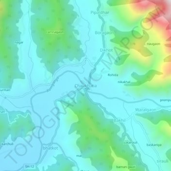
Name: Chaukhutia topographic map, elevation, terrain.

Location: Chaukhutia, Chaukhutiya, Almora, Uttarakhand, 263656, India (29.86560 79.33188 29.90560 79.37188)

Average elevation: 1,057 m

Minimum elevation: 909 m

Maximum elevation: 1,722 m

Gear up for your next adventure:

🥾Waterproof Hiking Boots - Boots keeping your feet dry in wet conditions
🥾Hiking Shoes - Durable and comfortable shoes for trail hiking
🔥Camping Stove - Portable stoves to cook outdoors with ease
🦯Trekking Poles - Reduced impact on joints for steep topographic climbs
🛶Canoe Life Vest - Safety vest for water sports

As an Amazon Associate, this site earns from qualifying purchases at no extra cost to you.