Geolocate

Moure topographic map

Click on the map to display elevation.

About this map

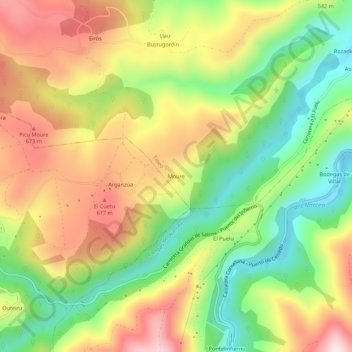
Name: Moure topographic map, elevation, terrain.

Location: Moure, Tineo, Asturias, España (43.21993 -6.55300 43.25993 -6.51300)

Average elevation: 520 m

Minimum elevation: 298 m

Maximum elevation: 767 m

Other topographic maps

Click on a map to view its topography, its elevation and its terrain.

Río Navelgas

España > Asturias > Tineo

Average elevation: 504 m

Gear up for your next adventure:

🧣Merino Neck Gaiter - Protects against wind, sun, and cold at high altitudes
🩹Compact First Aid Kit - Pre-packed essentials for common trail injuries
💡Solar Camping Lamp - Eco-friendly lighting for campsites
🩹Moleskin Blister Pads - Direct protection for painful foot pressure points
🐕Hiking Dog Pack - Let your canine companion carry their own water and food

As an Amazon Associate, this site earns from qualifying purchases at no extra cost to you.