
Ciroyom topographic map
Click on the map to display elevation.
About this map
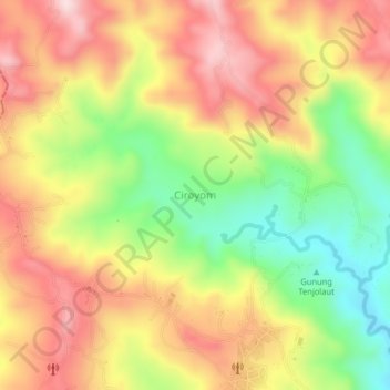
Name: Ciroyom topographic map, elevation, terrain.
Location: Ciroyom, Tasikmalaya, West Java, Java, Indonesia (-7.51202 107.95075 -7.47202 107.99075)
Average elevation: 787 m
Minimum elevation: 597 m
Maximum elevation: 955 m
Other topographic maps
Click on a map to view its topography, its elevation and its terrain.
Dusun Gunung Medang, Desa Kawitan, Kec. Salopa, Kab. Tasikmalaya
Indonesia > West Java > Tasikmalaya
Average elevation: 498 m
Dusun Cilangkap, Desa Cisempur, Kec. Cibalong, Kab. Tasikmalaya
Indonesia > West Java > Tasikmalaya > Cisempur
Average elevation: 198 m