Geolocate

Windujanten topographic map

Click on the map to display elevation.

About this map

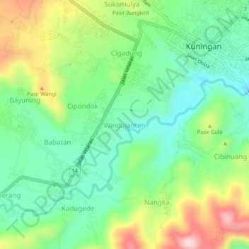
Name: Windujanten topographic map, elevation, terrain.

Location: Windujanten, Kuningan, West Java, Java, 45511, Indonesia (-7.01475 108.44400 -6.97475 108.48400)

Average elevation: 559 m

Minimum elevation: 452 m

Maximum elevation: 754 m

Other topographic maps

Click on a map to view its topography, its elevation and its terrain.

Gear up for your next adventure:

💡LED Headlamp - Hands-free illumination for night hiking and camping
🧤Rechargeable Heated Gloves - Extreme warmth for Canadian winter expeditions
🚲Bike Repair Kit - Essential tools for on-trail mechanical issues
🥾Mountaineering Boots - Supportive boots for climbing and high-altitude hiking
🧦Thermal Socks - Warm socks for winter hiking or camping

As an Amazon Associate, this site earns from qualifying purchases at no extra cost to you.