
San Carlos topographic map
Interactive map
Click on the map to display elevation.
About this map
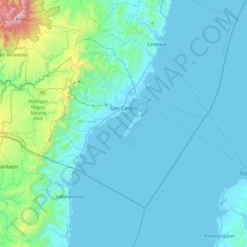
Name: San Carlos topographic map, elevation, terrain.
Location: San Carlos, West-Negros, Western Visayas, 6127, Philippinen (10.31607 123.13245 10.60250 123.55778)
Average elevation: 190 m
Minimum elevation: -2 m
Maximum elevation: 1,851 m
Other topographic maps
Click on a map to view its topography, its elevation and its terrain.
Murcia
Murcia, West-Negros, Western Visayas, 6129, Philippinen
Average elevation: 277 m