Geolocate

Gattareng topographic map

Click on the map to display elevation.

About this map

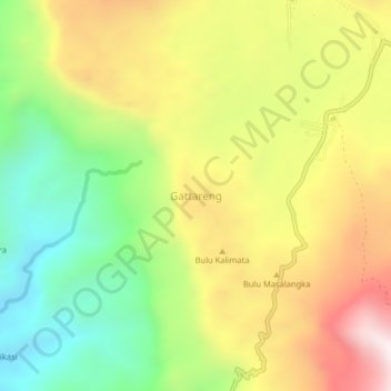
Name: Gattareng topographic map, elevation, terrain.

Location: Gattareng, Barru, South Sulawesi, Sulawesi, Indonesia (-4.74581 119.76261 -4.70581 119.80261)

Average elevation: 691 m

Minimum elevation: 270 m

Maximum elevation: 1,182 m

Gear up for your next adventure:

Bushcraft Tarp - Versatile emergency shelter or gear protection
🥾Light Trekking Boots - Supportive boots for multi-day treks
🌡️Emergency Mylar Blankets - Compact thermal protection for unexpected nights outdoors
🧥Packable Rain Jacket - Breathable waterproof layer for unpredictable weather
🧊Portable Cooler - Keep food and drinks cold during outdoor adventures

As an Amazon Associate, this site earns from qualifying purchases at no extra cost to you.