Geolocate

Agnières topographic map

Click on the map to display elevation.

About this map
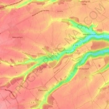
Name: Agnières topographic map, elevation, terrain.

Location: Agnières, Hescamps, Amiens, Somme, Hauts-de-France, France métropolitaine, 80290, France (49.69765 1.83765 49.73733 1.93333)

Average elevation: 184 m

Minimum elevation: 122 m

Maximum elevation: 207 m

Other topographic maps

Click on a map to view its topography, its elevation and its terrain.

Souplicourt

France > Hauts-de-France > Somme > Hescamps

Average elevation: 184 m

Mesnil Huchon

France > Hauts-de-France > Somme > Hescamps > Mesnil Huchon

Average elevation: 200 m

Gear up for your next adventure:

🦟Insect Repellent - Keep mosquitoes and black flies away in wooded areas
🥾Hiking Shorts - Breathable shorts suitable for summer hikes
🔭Outdoor Binoculars - Lightweight binoculars for birdwatching and hiking
🥾Hiking Boots - Sturdy boots providing ankle support and traction on rugged trails
💧Reusable Water Bottle - Durable water bottles for hydration on trails

As an Amazon Associate, this site earns from qualifying purchases at no extra cost to you.