Geolocate

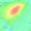
Tiruchendur topographic map

Click on the map to display elevation.

About this map

Name: Tiruchendur topographic map, elevation, terrain.

Location: Tiruchendur, Thoothukudi, Tamil Nadu, 628215, India (8.45557 78.08332 8.53557 78.16332)

Average elevation: 2 m

Minimum elevation: -2 m

Maximum elevation: 17 m

Other topographic maps

Click on a map to view its topography, its elevation and its terrain.

Kurangani

India > Tamil Nadu > Tiruchendur

Average elevation: 10 m

Gear up for your next adventure:

🧦Hiking Socks - Moisture-wicking and comfortable socks for long hikes
🍽️Titanium Camping Spork - Ultralight and indestructible eating utensil
🧴Outdoor Sunscreen - High SPF protection for high-altitude UV exposure
🥾Mountain Trail Shoes - High-traction shoes for mountain trails
🔋Solar Power Bank - Keep your GPS and devices charged during long outdoor trips

As an Amazon Associate, this site earns from qualifying purchases at no extra cost to you.