Geolocate

Corozal topographic map

Click on the map to display elevation.

Corozal

Se encuentra localizado en la región noreste del departamento de Sucre, a una altitud de 174 m s. n. m.

Wikipedia (CC-BY-SA 3.0)

About this map

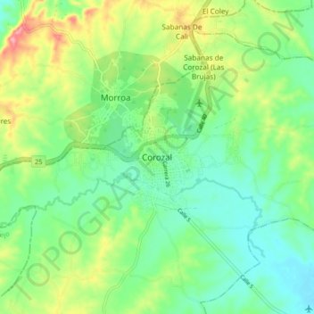
Name: Corozal topographic map, elevation, terrain.

Location: Corozal, Sabanas, Sucre, RAP Caribe, Colombia (9.15924 -75.45473 9.47924 -75.13473)

Average elevation: 148 m

Minimum elevation: 43 m

Maximum elevation: 381 m

Gear up for your next adventure:

🔪Outdoor Multitool - Versatile tool for repairs and food prep in the wild
🛏️Camping Sleeping Mat - Comfortable mats for sleeping outdoors
🧢Outdoor Visor - Breathable visor for sunny hikes
🛶Kayak Dry Bag - Waterproof storage for kayaking adventures
🛰️Satellite Messenger - Emergency communication for areas with no cell service

As an Amazon Associate, this site earns from qualifying purchases at no extra cost to you.