

Tronador topographic map
Click on the map to display elevation.
Tronador
Tronador (Spanish: Cerro Tronador) is an extinct stratovolcano in the southern Andes, located along the border between Argentina and Chile, near the Argentine city of Bariloche. The mountain was named Tronador (Spanish for "Thunderer") by locals in reference to the sound of falling seracs. With an altitude of 3,470 metres (11,380 ft), Tronador stands more than 1,000 m above nearby mountains in the Andean massif, making it a popular mountaineering destination. Located inside two national parks, Nahuel Huapi in Argentina and Vicente Pérez Rosales in Chile, Tronador hosts a total of eight glaciers, which are currently retreating due to warming of the upper troposphere.
About this map

Name: Tronador topographic map, elevation, terrain.
Average elevation: 2,836 m
Minimum elevation: 1,844 m
Maximum elevation: 3,429 m
Other topographic maps
Click on a map to view its topography, its elevation and its terrain.
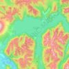
Todos los Santos Lake
Chile > Los Lagos Region > Provincia de Llanquihue > Puerto Varas
Average elevation: 690 m