Geolocate

Uxmal topographic map

Click on the map to display elevation.

About this map

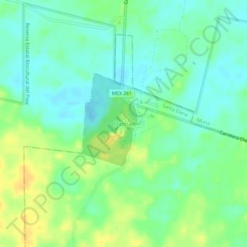
Name: Uxmal topographic map, elevation, terrain.

Location: Uxmal, Santa Elena, Yucatán, 97890, Mexico (20.34029 -89.79056 20.38029 -89.75056)

Average elevation: 51 m

Minimum elevation: 40 m

Maximum elevation: 67 m

Gear up for your next adventure:

🧥Thermal Layer - Insulating layer for cold outdoor conditions
🦶Anti-Blister Balm - Prevents friction and hotspots during long ascents
🥾Hiking Gaiters - Protect legs and shoes from mud, snow, and debris
🧦Crew Hiking Socks - Comfortable socks for long-distance hikes
💧Reusable Water Bottle - Durable water bottles for hydration on trails

As an Amazon Associate, this site earns from qualifying purchases at no extra cost to you.