Geolocate

Embulbul topographic map

Click on the map to display elevation.

About this map

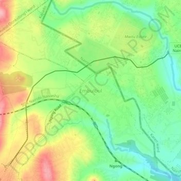
Name: Embulbul topographic map, elevation, terrain.

Location: Embulbul, Oloolua ward, Kajiado North, Kajiado County, Kenya (-1.35503 36.65561 -1.31503 36.69561)

Average elevation: 1,890 m

Minimum elevation: 1,835 m

Maximum elevation: 1,964 m

Gear up for your next adventure:

💧Hydration Bladder - Hands-free hydration solution for long treks
🥽Outdoor Goggles - Protective eyewear for outdoor activities
🪑Insulated Seat Pad - Protect your seat from cold rocks and wet logs
🛌Insulated Sleeping Pad - Critical thermal barrier between you and the cold ground
🧰Emergency Multi-Tool - Compact multi-tool for outdoor survival

As an Amazon Associate, this site earns from qualifying purchases at no extra cost to you.