
Silver Firs topographic map
Click on the map to display elevation.
About this map
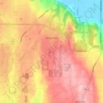
Name: Silver Firs topographic map, elevation, terrain.
Location: Silver Firs, Snohomish County, Washington, United States (47.83419 -122.18708 47.89136 -122.11109)
Average elevation: 122 m
Minimum elevation: -2 m
Maximum elevation: 199 m
Other topographic maps
Click on a map to view its topography, its elevation and its terrain.