Geolocate

Pathardi topographic map

Click on the map to display elevation.

About this map

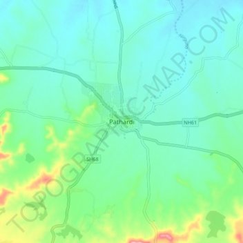
Name: Pathardi topographic map, elevation, terrain.

Location: Pathardi, Ahmednagar District, Maharashtra, 414102, India (19.13172 75.13456 19.21172 75.21456)

Average elevation: 553 m

Minimum elevation: 516 m

Maximum elevation: 685 m

Gear up for your next adventure:

🧰Survival Kit - Essential gear for emergencies in the wilderness
🥾Waterproof Hiking Shoes - Durable shoes for wet and rugged trails
🩹Compact First Aid Kit - Pre-packed essentials for common trail injuries
Camping Coffee Maker - Brew fresh coffee anywhere on the topographic map
🦟Insect Repellent - Keep mosquitoes and black flies away in wooded areas

As an Amazon Associate, this site earns from qualifying purchases at no extra cost to you.