Geolocate

Pang topographic map

Click on the map to display elevation.

Pang

Höhepunkte des kulturellen Lebens bilden u. a. das Panger Volksfest und das Vatertagsfest des ansässigen Sportvereins SV Pang 1950 sowie die drei Dorffeste, die jeweils von der Freiwilligen Feuerwehr Pang, dem Krieger- und Reservistenverein sowie dem Trachtenverein GTEV d’Kaltentaler Pang ausgetragen werden.

Wikipedia (CC-BY-SA 3.0)

About this map

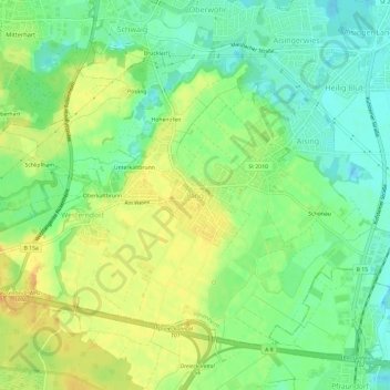
Name: Pang topographic map, elevation, terrain.

Location: Pang, Rosenheim, Bayern, 83026, Deutschland (47.80462 12.07442 47.84462 12.11442)

Average elevation: 461 m

Minimum elevation: 445 m

Maximum elevation: 477 m

Other topographic maps

Click on a map to view its topography, its elevation and its terrain.

83024

Deutschland > Bayern > Rosenheim > Westerndorf St. Peter

Average elevation: 453 m

83022

Deutschland > Bayern > Rosenheim

Average elevation: 450 m

Pösling

Deutschland > Bayern > Rosenheim > Pang

Average elevation: 460 m

Gear up for your next adventure:

🧼Biodegradable Camp Soap - Environmentally friendly cleaning for gear and body
❄️Traction Ice Cleats - Slip-on spikes for icy trails and winter hiking
🌬️Windproof Camp Stove - Efficient cooking even on exposed mountain peaks
🥾Light Hiking Boots - Lightweight and comfortable boots for day hikes
🎒Hiking Daypack - Lightweight and durable backpacks for day trips and excursions

As an Amazon Associate, this site earns from qualifying purchases at no extra cost to you.