
Knocke topographic map
Interactive map
Click on the map to display elevation.
About this map
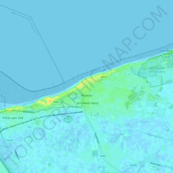
Name: Knocke topographic map, elevation, terrain.
Average elevation: 2 m
Minimum elevation: -2 m
Maximum elevation: 21 m
Other topographic maps
Click on a map to view its topography, its elevation and its terrain.
Knocke-Heist
Belgique > Flandre-Occidentale > Bruges > Knocke-Heist > Knocke
Knocke-Heist, Knocke, Knocke-Heist, Bruges, Flandre-Occidentale, Flandre, 8300, Belgique
Average elevation: 2 m