Geolocate

泰山 topographic map

Click on the map to display elevation.

About this map

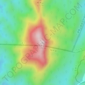
Name: 泰山 topographic map, elevation, terrain.

Location: 泰山, Xuancheng, Anhui, China (30.61961 119.22196 30.61971 119.22206)

Average elevation: 400 m

Minimum elevation: 200 m

Maximum elevation: 750 m

Gear up for your next adventure:

🔦UV Flashlight - Detect minerals or specific insects in the dark
🥾Lightweight Hiking Shoes - Comfortable shoes for day hikes
🥾Trail Running Boots - Durable shoes designed for trail running
🔥Camping Stove - Portable stoves to cook outdoors with ease
💧Hydration Bladder - Hands-free hydration solution for long treks

As an Amazon Associate, this site earns from qualifying purchases at no extra cost to you.