Geolocate

Kiron topographic map

Click on the map to display elevation.

About this map

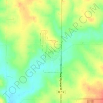
Name: Kiron topographic map, elevation, terrain.

Location: Kiron, Crawford County, Iowa, United States (42.18941 -95.33083 42.20029 -95.32336)

Average elevation: 412 m

Minimum elevation: 387 m

Maximum elevation: 440 m

Gear up for your next adventure:

🗺️Topographic Maps - Detailed maps to explore trails, mountains, and wilderness areas
🧰Emergency Multi-Tool - Compact multi-tool for outdoor survival
🛌Down Sleeping Bag - Superior warmth-to-weight ratio for cold nights
🧤Insulated Winter Gloves - Heavy-duty protection for sub-zero Canadian adventures
🧤Rechargeable Heated Gloves - Extreme warmth for Canadian winter expeditions

As an Amazon Associate, this site earns from qualifying purchases at no extra cost to you.