Geolocate

Trofaiach topographic map

Click on the map to display elevation.

About this map

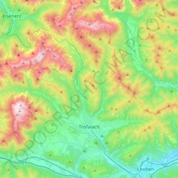
Name: Trofaiach topographic map, elevation, terrain.

Location: Trofaiach, Bezirk Leoben, Styria, 8793, Austria (47.39392 14.83300 47.53616 15.11081)

Average elevation: 1,066 m

Minimum elevation: 508 m

Maximum elevation: 2,191 m

Other topographic maps

Click on a map to view its topography, its elevation and its terrain.

Erzberg

Austria > Styria > Bezirk Leoben > Eisenerz

Average elevation: 1,115 m

Gear up for your next adventure:

🧳Compression Sacks - Maximize space in your backpack by shrinking gear
🧦Thermal Socks - Warm socks for winter hiking or camping
🛏️Camping Sleeping Mat - Comfortable mats for sleeping outdoors
🧴First Aid Kit - Essential first aid supplies for outdoor emergencies
🔭Compact Monocular - One-handed bird watching and trail spotting

As an Amazon Associate, this site earns from qualifying purchases at no extra cost to you.