
Thank you for supporting this site ❤️
Make a donation
Make a donation
Gear up for your next adventure:
As an Amazon Associate, this site earns from qualifying purchases at no extra cost to you.
مرصع topographic map
Click on the map to display elevation.
Thank you for supporting this site ❤️
Make a donation
Make a donation
Gear up for your next adventure:
As an Amazon Associate, this site earns from qualifying purchases at no extra cost to you.
About this map
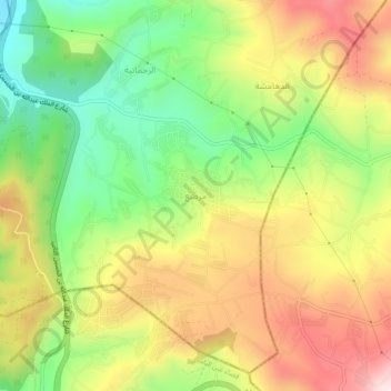
Name: مرصع topographic map, elevation, terrain.
Location: مرصع, Mestabah Sub-District, Qasabah Jerash, Jarash, Jordan (32.11701 35.85101 32.15701 35.89101)
Average elevation: 714 m
Minimum elevation: 475 m
Maximum elevation: 977 m
Thank you for supporting this site ❤️
Make a donation
Make a donation
Gear up for your next adventure:
As an Amazon Associate, this site earns from qualifying purchases at no extra cost to you.