Geolocate

Alto los Riegos topographic map

Click on the map to display elevation.

About this map

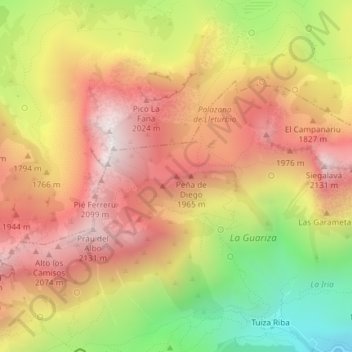
Name: Alto los Riegos topographic map, elevation, terrain.

Location: Alto los Riegos, Lena, Asturias, 33628, España (43.03868 -5.92899 43.03878 -5.92889)

Average elevation: 1,713 m

Minimum elevation: 1,123 m

Maximum elevation: 2,161 m

Other topographic maps

Click on a map to view its topography, its elevation and its terrain.

Río Huerna

España > Asturias > Lena

Average elevation: 1,041 m

Riospaso

España > Asturias > Lena

Average elevation: 1,115 m

Gear up for your next adventure:

🪑Insulated Seat Pad - Protect your seat from cold rocks and wet logs
🌡️Emergency Mylar Blankets - Compact thermal protection for unexpected nights outdoors
💡LED Headlamp - Hands-free illumination for night hiking and camping
🥾Approach Shoes - Shoes designed for climbing approaches and rugged trails
💧Hydration Bladder - Hands-free hydration solution for long treks

As an Amazon Associate, this site earns from qualifying purchases at no extra cost to you.