Geolocate

Llaclla topographic map

Click on the map to display elevation.

About this map

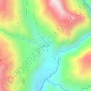
Name: Llaclla topographic map, elevation, terrain.

Location: Llaclla, Abelardo Pardo Lezameta, Bolognesi, Áncash, Perú (-10.31928 -77.16633 -10.27928 -77.12633)

Average elevation: 2,444 m

Minimum elevation: 1,933 m

Maximum elevation: 3,154 m

Gear up for your next adventure:

🧰Survival Kit - Essential gear for emergencies in the wilderness
💡LED Camping Lantern - Illuminate your campsite with long-lasting lanterns
🪑Ultralight Camping Stool - Compact seating for rest stops during long hikes
🧼Travel Hand Sanitizer - Keep hands clean when water is scarce
🧥Waterproof Pants - Keep dry during rainy hiking conditions

As an Amazon Associate, this site earns from qualifying purchases at no extra cost to you.