
Thank you for supporting this site ❤️
Make a donation
Make a donation
Gear up for your next adventure:
As an Amazon Associate, this site earns from qualifying purchases at no extra cost to you.
392 topographic map
Click on the map to display elevation.
Thank you for supporting this site ❤️
Make a donation
Make a donation
Gear up for your next adventure:
As an Amazon Associate, this site earns from qualifying purchases at no extra cost to you.
About this map
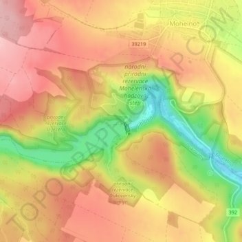
Name: 392 topographic map, elevation, terrain.
Location: 392, Mohelno, okres Třebíč, Vysočina Region, 675 75, Czechia (49.10316 16.17956 49.10326 16.17966)
Average elevation: 355 m
Minimum elevation: 258 m
Maximum elevation: 415 m
Thank you for supporting this site ❤️
Make a donation
Make a donation
Gear up for your next adventure:
As an Amazon Associate, this site earns from qualifying purchases at no extra cost to you.