
Thank you for supporting this site ❤️
Make a donation
Make a donation
Gear up for your next adventure:
As an Amazon Associate, this site earns from qualifying purchases at no extra cost to you.
Çatak topographic map
Click on the map to display elevation.
Thank you for supporting this site ❤️
Make a donation
Make a donation
Gear up for your next adventure:
As an Amazon Associate, this site earns from qualifying purchases at no extra cost to you.
About this map
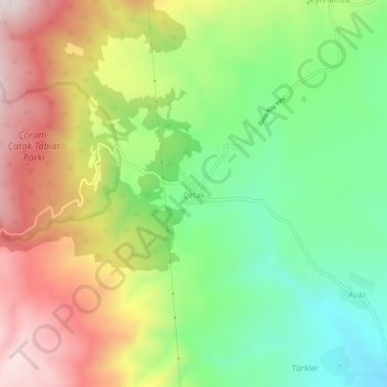
Name: Çatak topographic map, elevation, terrain.
Location: Çatak, Çorum Merkez, Çorum, Région de la mer Noire, Turquie (40.66732 34.81431 40.70732 34.85431)
Average elevation: 1,289 m
Minimum elevation: 1,009 m
Maximum elevation: 1,647 m
Thank you for supporting this site ❤️
Make a donation
Make a donation
Gear up for your next adventure:
As an Amazon Associate, this site earns from qualifying purchases at no extra cost to you.