Geolocate

Paragueda topographic map

Click on the map to display elevation.

About this map

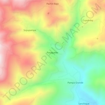
Name: Paragueda topographic map, elevation, terrain.

Location: Paragueda, Otuzco, La Libertad, Perú (-7.92294 -78.64518 -7.88294 -78.60518)

Average elevation: 3,253 m

Minimum elevation: 2,859 m

Maximum elevation: 3,689 m

Gear up for your next adventure:

🕶️Polarized Sunglasses - Reduces glare from snow and water at high elevations
🧼Biodegradable Camp Soap - Environmentally friendly cleaning for gear and body
🧥Fleece Jacket - Warm and lightweight jacket for layering
🧊Insulated Water Bottle - Keeps drinks cold in summer and prevents freezing in winter
🥾Mountain Trail Shoes - High-traction shoes for mountain trails

As an Amazon Associate, this site earns from qualifying purchases at no extra cost to you.