Geolocate

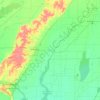
Paragould topographic map

Click on the map to display elevation.

About this map

Name: Paragould topographic map, elevation, terrain.

Location: Paragould, Greene County, Arkansas, United States (35.98729 -90.59061 36.10455 -90.44014)

Average elevation: 91 m

Minimum elevation: 67 m

Maximum elevation: 149 m

Other topographic maps

Click on a map to view its topography, its elevation and its terrain.
Beech Grove

United States > Arkansas > Greene County

Average elevation: 105 m

Big Island

United States > Arkansas > Greene County

Average elevation: 84 m

Gear up for your next adventure:

🥾Waterproof Hiking Boots - Boots keeping your feet dry in wet conditions
🧴Bear Spray Holster - Quick-access carry for essential Canadian wilderness safety
🥫Freeze-Dried Meals - Lightweight, high-calorie nutrition for multi-day treks
🧼Travel Hand Sanitizer - Keep hands clean when water is scarce
🥾Approach Shoes - Shoes designed for climbing approaches and rugged trails

As an Amazon Associate, this site earns from qualifying purchases at no extra cost to you.