
Make a donation
Gear up for your next adventure:
As an Amazon Associate, this site earns from qualifying purchases at no extra cost to you.
Kastelberg topographic map
Click on the map to display elevation.
Make a donation
Gear up for your next adventure:
As an Amazon Associate, this site earns from qualifying purchases at no extra cost to you.
Kastelberg
Le Kastelberg est le quatrième plus haut sommet du massif des Vosges avec 1 350 mètres d'altitude formant l'ancienne limite régionale entre l'Alsace (Haut-Rhin) et la Lorraine (Vosges).
Make a donation
Gear up for your next adventure:
As an Amazon Associate, this site earns from qualifying purchases at no extra cost to you.
About this map
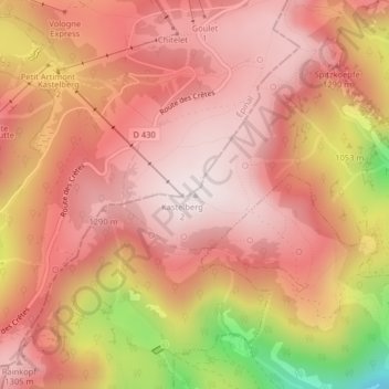
Name: Kastelberg topographic map, elevation, terrain.
Average elevation: 1,135 m
Minimum elevation: 628 m
Maximum elevation: 1,350 m
Make a donation
Gear up for your next adventure:
As an Amazon Associate, this site earns from qualifying purchases at no extra cost to you.
Other topographic maps
Click on a map to view its topography, its elevation and its terrain.