
Puchong topographic map
Click on the map to display elevation.
About this map
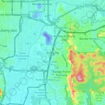
Name: Puchong topographic map, elevation, terrain.
Average elevation: 38 m
Minimum elevation: -49 m
Maximum elevation: 197 m
Other topographic maps
Click on a map to view its topography, its elevation and its terrain.
Ayer Hitam Permanent Forest Reserve
Malaysia > Selangor > Subang Jaya City Council > Puchong
Average elevation: 75 m
Bandar Puteri Puchong
Malaysia > Selangor > Subang Jaya City Council > Puchong
Average elevation: 59 m