Geolocate

Pietrafitta topographic map

Click on the map to display elevation.

About this map

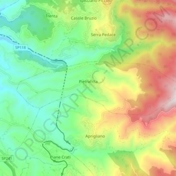
Name: Pietrafitta topographic map, elevation, terrain.

Location: Pietrafitta, Cosenza, Calabria, Italy (39.24920 16.30516 39.26868 16.38731)

Average elevation: 681 m

Minimum elevation: 322 m

Maximum elevation: 1,279 m

Other topographic maps

Click on a map to view its topography, its elevation and its terrain.

Savuto

Italy > Calabria > Cosenza > Cleto

Average elevation: 284 m

Lago dell'Esaro

Italy > Calabria > Cosenza > Roggiano Gravina

Average elevation: 156 m

Gear up for your next adventure:

🥾Trekking Boots - Durable boots for long-distance trekking
🧥Thermal Fleece Jacket - Versatile insulation for changing mountain temperatures
Backpacking Tent - Lightweight tent for long-distance hiking trips
🔥Camping Stove - Portable stoves to cook outdoors with ease
🥾Trail Running Shoes - Lightweight and durable shoes for trail running

As an Amazon Associate, this site earns from qualifying purchases at no extra cost to you.