Geolocate

Steinmark topographic map

Click on the map to display elevation.

Steinmark

Esselbach mit Faun, Karlshöhe, Schleifthor, Wagenmühle (alte) und Wagenmühle (neue) | Kredenbach | Steinmark mit Heinrichsmühle und Kieseckersmühle

Wikipedia (CC-BY-SA 3.0)

About this map

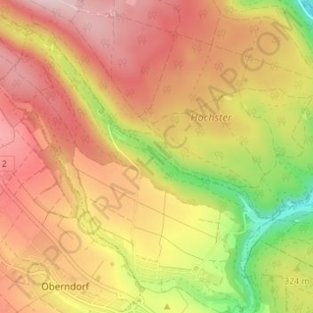
Name: Steinmark topographic map, elevation, terrain.

Location: Steinmark, Kredenbach, Esselbach, Verwaltungsgemeinschaft Marktheidenfeld, Landkreis Main-Spessart, Bayern, 97839, Deutschland (49.85751 9.48898 49.89709 9.54903)

Average elevation: 350 m

Minimum elevation: 181 m

Maximum elevation: 469 m

Gear up for your next adventure:

🍽️Titanium Camping Spork - Ultralight and indestructible eating utensil
🧥Waterproof Jacket - Lightweight rain jackets for hiking and outdoor activities
🪑Ultralight Camping Stool - Compact seating for rest stops during long hikes
🕶️Polarized Sunglasses - Reduces glare from snow and water at high elevations
🧤Insulated Winter Gloves - Heavy-duty protection for sub-zero Canadian adventures

As an Amazon Associate, this site earns from qualifying purchases at no extra cost to you.