
Thank you for supporting this site ❤️
Make a donation
Make a donation
Gear up for your next adventure:
As an Amazon Associate, this site earns from qualifying purchases at no extra cost to you.
Estaon topographic map
Click on the map to display elevation.
Thank you for supporting this site ❤️
Make a donation
Make a donation
Gear up for your next adventure:
As an Amazon Associate, this site earns from qualifying purchases at no extra cost to you.
About this map
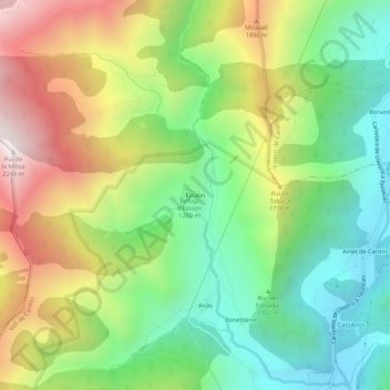
Name: Estaon topographic map, elevation, terrain.
Location: Estaon, Vall de Cardós, Pallars Sobirà, Catalonia, 25570, Spain (42.56762 1.19131 42.60762 1.23131)
Average elevation: 1,434 m
Minimum elevation: 904 m
Maximum elevation: 2,237 m
Thank you for supporting this site ❤️
Make a donation
Make a donation
Gear up for your next adventure:
As an Amazon Associate, this site earns from qualifying purchases at no extra cost to you.