
Thank you for supporting this site ❤️
Make a donation
Make a donation
Gear up for your next adventure:
As an Amazon Associate, this site earns from qualifying purchases at no extra cost to you.
St-Pierre-Jolys topographic map
Click on the map to display elevation.
Thank you for supporting this site ❤️
Make a donation
Make a donation
Gear up for your next adventure:
As an Amazon Associate, this site earns from qualifying purchases at no extra cost to you.
About this map
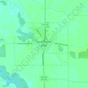
Name: St-Pierre-Jolys topographic map, elevation, terrain.
Location: St-Pierre-Jolys, Division No 2, Manitoba, R0A 1V0, Canada (49.43361 -96.99924 49.44663 -96.97393)
Average elevation: 239 m
Minimum elevation: 234 m
Maximum elevation: 243 m
Thank you for supporting this site ❤️
Make a donation
Make a donation
Gear up for your next adventure:
As an Amazon Associate, this site earns from qualifying purchases at no extra cost to you.