
Make a donation
Gear up for your next adventure:
As an Amazon Associate, this site earns from qualifying purchases at no extra cost to you.
Rena topographic map
Click on the map to display elevation.
Make a donation
Gear up for your next adventure:
As an Amazon Associate, this site earns from qualifying purchases at no extra cost to you.
About this map
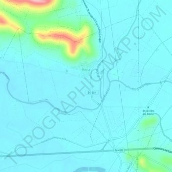
Name: Rena topographic map, elevation, terrain.
Location: Rena, Badajoz, Extremadura, Spain (39.03176 -5.82986 39.06707 -5.77544)
Average elevation: 267 m
Minimum elevation: 246 m
Maximum elevation: 408 m
Make a donation
Gear up for your next adventure:
As an Amazon Associate, this site earns from qualifying purchases at no extra cost to you.
Other topographic maps
Click on a map to view its topography, its elevation and its terrain.
Madrigal de la Vera
Spain > Extremadura > La Vera > Madrigal de la Vera > Madrigal de la Vera
Average elevation: 400 m
Make a donation
Gear up for your next adventure:
As an Amazon Associate, this site earns from qualifying purchases at no extra cost to you.