Geolocate

Valur topographic map

Click on the map to display elevation.

About this map

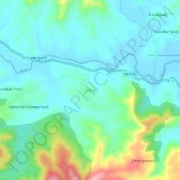
Name: Valur topographic map, elevation, terrain.

Location: Valur, Shahuwadi, Kolhapur, Maharashtra, 415101, India (16.92484 73.85855 16.96484 73.89855)

Average elevation: 610 m

Minimum elevation: 562 m

Maximum elevation: 770 m

Other topographic maps

Click on a map to view its topography, its elevation and its terrain.

Panhala Fort

India > Maharashtra > Shahuwadi > Panhala

Average elevation: 825 m

Panhala Fort

India > Maharashtra > Shahuwadi > Panhala

Average elevation: 825 m

Gear up for your next adventure:

🥾Mountaineering Boots - Supportive boots for climbing and high-altitude hiking
🥾Waterproof Hiking Boots - Essential footwear for rugged terrain and wet Canadian trails
🛶Kayak Dry Bag - Waterproof storage for kayaking adventures
🪑Ultralight Camping Stool - Compact seating for rest stops during long hikes
🎒Hiking Backpack - Lightweight and ergonomic backpacks for day hikes or multi-day treks

As an Amazon Associate, this site earns from qualifying purchases at no extra cost to you.