Geolocate

Tapae topographic map

Click on the map to display elevation.

About this map

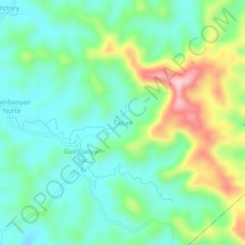
Name: Tapae topographic map, elevation, terrain.

Location: Tapae, Calbayog, Samar, Eastern Visayas, 6710, Philippines (12.07418 124.62635 12.11418 124.66635)

Average elevation: 94 m

Minimum elevation: 17 m

Maximum elevation: 272 m

Other topographic maps

Click on a map to view its topography, its elevation and its terrain.

Gear up for your next adventure:

🛏️Sleeping Bag - Warm and compact sleeping bags for outdoor camping
🕶️Polarized Sunglasses - Reduces glare from snow and water at high elevations
🥾Lightweight Hiking Boots - Boots for comfort and mobility on long hikes
Backpacking Tent - Lightweight tent for long-distance hiking trips
🥾Approach Shoes - Shoes designed for climbing approaches and rugged trails

As an Amazon Associate, this site earns from qualifying purchases at no extra cost to you.