Geolocate

Campodonico topographic map

Click on the map to display elevation.

About this map

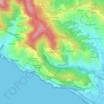
Name: Campodonico topographic map, elevation, terrain.

Location: Campodonico, Chiavari, Genoa, Liguria, 16043, Italy (44.31716 9.27484 44.35716 9.31484)

Average elevation: 167 m

Minimum elevation: 0 m

Maximum elevation: 579 m

Gear up for your next adventure:

🥾All-Terrain Hiking Boots - Versatile boots for varied hiking conditions
👟Trail Running Shoes - Agile footwear for fast-paced topographic exploration
🧭GPS Handheld Device - Reliable GPS navigation for outdoor adventures
🕶️Polarized Sunglasses - Protect your eyes with durable polarized lenses
🧊Insulated Water Bottle - Keeps drinks cold in summer and prevents freezing in winter

As an Amazon Associate, this site earns from qualifying purchases at no extra cost to you.