Geolocate

Salinas topographic map

Click on the map to display elevation.

About this map

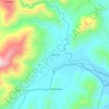
Name: Salinas topographic map, elevation, terrain.

Location: Salinas, Nueva Vizcaya, Cagayan Valley, Philippines (16.35244 121.00127 16.39244 121.04127)

Average elevation: 524 m

Minimum elevation: 379 m

Maximum elevation: 912 m

Other topographic maps

Click on a map to view its topography, its elevation and its terrain.

Kasibu River

Philippines > Nueva Vizcaya > Kasibu

Average elevation: 866 m

Kayapa

Philippines > Nueva Vizcaya

Average elevation: 1,258 m

Gear up for your next adventure:

🧤Thermal Hiking Gloves - Grip-enhanced gloves for cold-weather altitude trekking
🌡️Emergency Mylar Blankets - Compact thermal protection for unexpected nights outdoors
🥾Lightweight Hiking Shoes - Comfortable shoes for day hikes
🧭GPS Handheld Device - Reliable GPS navigation for outdoor adventures
🕯️Camping Lantern - Illuminates your entire campsite with high-efficiency LEDs

As an Amazon Associate, this site earns from qualifying purchases at no extra cost to you.