Geolocate

Covanera topographic map

Click on the map to display elevation.

About this map

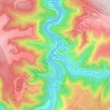
Name: Covanera topographic map, elevation, terrain.

Location: Covanera, Tubilla del Agua, Burgos, Castilla y León, España (42.71387 -3.82172 42.75387 -3.78172)

Average elevation: 878 m

Minimum elevation: 680 m

Maximum elevation: 1,051 m

Gear up for your next adventure:

🩹Moleskin Blister Pads - Direct protection for painful foot pressure points
🪑Ultralight Camping Stool - Compact seating for rest stops during long hikes
Tent Footprint - Protect tent floor and increase durability
🧶550 Survival Paracord - Versatile utility cord for emergency repairs and rigging
💡LED Headlamp - Hands-free illumination for night hiking and camping

As an Amazon Associate, this site earns from qualifying purchases at no extra cost to you.