Geolocate

Castagnorfa topographic map

Click on the map to display elevation.

About this map
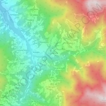
Name: Castagnorfa topographic map, elevation, terrain.

Location: Castagnorfa, Bardi, Parma, Emilia-Romagna, 43032, Italy (44.57050 9.74969 44.61050 9.78969)

Average elevation: 700 m

Minimum elevation: 417 m

Maximum elevation: 1,134 m

Gear up for your next adventure:

⛺Backpacking Tent - Lightweight tent for long-distance hiking trips
🔦LED Headtorch - Bright and durable light for night activities
☕Camping Coffee Maker - Brew fresh coffee anywhere on the topographic map
🥾Trail Hiking Shoes - Durable shoes designed for rugged trails
🧰Emergency Multi-Tool - Compact multi-tool for outdoor survival

As an Amazon Associate, this site earns from qualifying purchases at no extra cost to you.