Geolocate

Binalonan topographic map

Click on the map to display elevation.

About this map

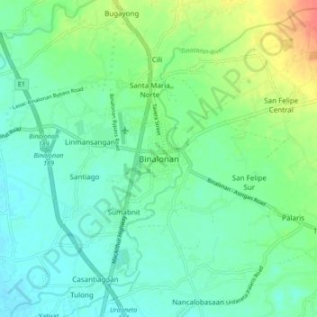
Name: Binalonan topographic map, elevation, terrain.

Location: Binalonan, Pangasinan, Ilocos Region, 2436, Philippines (16.00445 120.55177 16.08445 120.63177)

Average elevation: 38 m

Minimum elevation: 24 m

Maximum elevation: 72 m

Gear up for your next adventure:

🔋Emergency Crank Radio - Weather alerts and power without needing batteries
🧣Merino Neck Gaiter - Protects against wind, sun, and cold at high altitudes
🧤Thermal Hiking Gloves - Grip-enhanced gloves for cold-weather altitude trekking
🧥Insulated Jacket - Keep warm in cold outdoor conditions
🥾Mountaineering Boots - Supportive boots for climbing and high-altitude hiking

As an Amazon Associate, this site earns from qualifying purchases at no extra cost to you.