Geolocate

Großraschütz topographic map

Click on the map to display elevation.

About this map

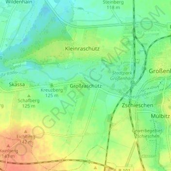
Name: Großraschütz topographic map, elevation, terrain.

Location: Großraschütz, Großenhain, Meißen, Sachsen, 01558, Deutschland (51.26769 13.48188 51.30769 13.52188)

Average elevation: 123 m

Minimum elevation: 106 m

Maximum elevation: 148 m

Other topographic maps

Click on a map to view its topography, its elevation and its terrain.

Colmnitz

Deutschland > Sachsen > Meißen > Großenhain

Average elevation: 120 m

Bauda

Deutschland > Sachsen > Meißen > Großenhain

Average elevation: 113 m

Gear up for your next adventure:

🔭Compact Monocular - One-handed bird watching and trail spotting
🥾Mountaineering Boots - Supportive boots for climbing and high-altitude hiking
🦶Hiking Shoe Insoles - Added support for high arches and long days on feet
Camping Essentials - All-in-one gear for a comfortable camping trip
🧰Emergency Multi-Tool - Compact multi-tool for outdoor survival

As an Amazon Associate, this site earns from qualifying purchases at no extra cost to you.