
Thank you for supporting this site ❤️
Make a donation
Make a donation
Gear up for your next adventure:
As an Amazon Associate, this site earns from qualifying purchases at no extra cost to you.
Pette topographic map
Click on the map to display elevation.
Thank you for supporting this site ❤️
Make a donation
Make a donation
Gear up for your next adventure:
As an Amazon Associate, this site earns from qualifying purchases at no extra cost to you.
About this map
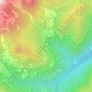
Name: Pette topographic map, elevation, terrain.
Location: Pette, Don di Gosaldo, Gosaldo, Belluno, Veneto, 32020, Italia (46.19571 11.93496 46.23571 11.97496)
Average elevation: 1,174 m
Minimum elevation: 626 m
Maximum elevation: 1,988 m
Thank you for supporting this site ❤️
Make a donation
Make a donation
Gear up for your next adventure:
As an Amazon Associate, this site earns from qualifying purchases at no extra cost to you.