Geolocate

Verona topographic map

Click on the map to display elevation.

About this map

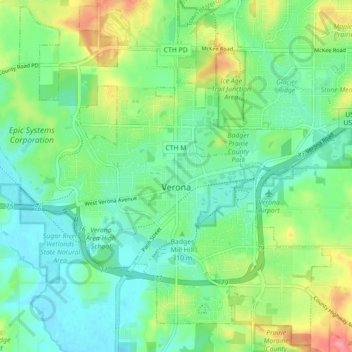
Name: Verona topographic map, elevation, terrain.

Location: Verona, Dane County, Wisconsin, 53593, United States (42.96146 -89.58305 43.02374 -89.49461)

Average elevation: 308 m

Minimum elevation: 280 m

Maximum elevation: 370 m

Other topographic maps

Click on a map to view its topography, its elevation and its terrain.

Hope

United States > Wisconsin > Dane County

Average elevation: 269 m

Gear up for your next adventure:

🥾Light Trekking Boots - Supportive boots for multi-day treks
🥫Freeze-Dried Meals - Lightweight, high-calorie nutrition for multi-day treks
🧢Outdoor Cap - Protective cap for sun and rain during hikes
💡Portable Camping Lamp - Rechargeable lamp for campsite lighting
Family Camping Tent - Spacious tent suitable for family camping trips

As an Amazon Associate, this site earns from qualifying purchases at no extra cost to you.