
Palladam topographic map
Click on the map to display elevation.
Palladam
Palladam is located at 10°59′N 77°18′E / 10.98°N 77.3°E / 10.98; 77.3. It has an average elevation of 325 metres (1,066 feet). Palladam is located near to Tirupur (14 km away) which is called the 'Dollar City' of Tamil Nadu and located 38 km east of the city of Coimbatore, ‘‘‘Manchester of South India‘‘‘ . Palladam is the gateway to Coimbatore from the eastern and south-eastern parts of Tamil Nadu. The soil is predominantly Red, suitable for cultivating vegetables and other cash crops.
About this map
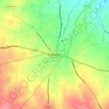
Name: Palladam topographic map, elevation, terrain.
Location: Palladam, Tiruppur District, Tamil Nadu, 638664, India (10.95623 77.24356 11.03623 77.32356)
Average elevation: 377 m
Minimum elevation: 336 m
Maximum elevation: 421 m