Geolocate

Chimalhuacán topographic map

Click on the map to display elevation.

About this map

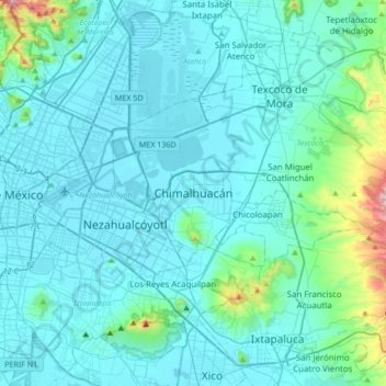
Name: Chimalhuacán topographic map, elevation, terrain.

Location: Chimalhuacán, 56351, Mexico (19.27393 -99.11801 19.59393 -98.79801)

Average elevation: 2,304 m

Minimum elevation: 2,223 m

Maximum elevation: 3,061 m

Gear up for your next adventure:

🛏️Sleeping Bag - Warm and compact sleeping bags for outdoor camping
Family Camping Tent - Spacious tent suitable for family camping trips
🦌Outdoor Trail Camera - Monitor wildlife activity near your favorite spots
👟Trail Running Shoes - Agile footwear for fast-paced topographic exploration
🛌Insulated Sleeping Pad - Critical thermal barrier between you and the cold ground

As an Amazon Associate, this site earns from qualifying purchases at no extra cost to you.