Geolocate

Pandojhari topographic map

Click on the map to display elevation.

About this map

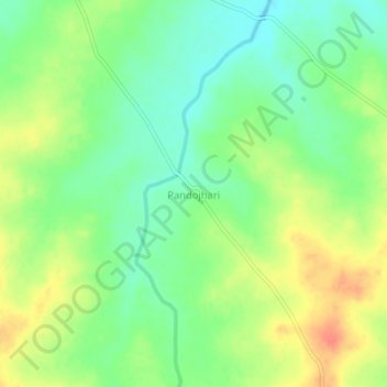
Name: Pandojhari topographic map, elevation, terrain.

Location: Pandojhari, Jat, Sangli District, Maharashtra, India (17.01912 75.50055 17.05912 75.54055)

Average elevation: 539 m

Minimum elevation: 518 m

Maximum elevation: 565 m

Gear up for your next adventure:

🧥Waterproof Jacket - Lightweight rain jackets for hiking and outdoor activities
🧶550 Survival Paracord - Versatile utility cord for emergency repairs and rigging
🧊Insulated Water Bottle - Keeps drinks cold in summer and prevents freezing in winter
🕶️Polarized Sunglasses - Protect your eyes with durable polarized lenses
🧳Compression Sacks - Maximize space in your backpack by shrinking gear

As an Amazon Associate, this site earns from qualifying purchases at no extra cost to you.